This 4K camping music video explores the Keweenaw Peninsula which extends northeast from Michigan's Upper Peninsula. Copper Harbor Michigan is the community furthest north on the Keweenaw. "Where the road ends and adventure begins," is how their local tourist group describes the area. (Copper Harbor Improvement Association) Copper Harbor is very remote. It literally is where highway US-41 ends and is also the spot in the lower 48 of the United States of America that's farther than anywhere else from an US Interstate Highway.
In August, my son Bryce and I headed to Copper Harbor for some camping, hiking sightseeing and waterfalling. We camped at Fort Wilkins State Park. There they have reconstructed a fort that was built in 1847 to help keep the peace during the copper mining boom which lasted from 1845 until 1887. After Michigan's first state geologist Douglas Houghton "discovered" copper in 1841, thousands of people migrated to the Keweenaw peninsula to work in the mines, similar to what would happen in the better known California Gold Rush in 1849. I put discovered in quotes because Native Americans had actually been mining copper in pit mines for a very long time before Houghton's discovery. One of the highlights of our trip was a self-guided tour 100 feet below the surface into the Delaware Copper Mine and exploring the ruins above ground too.
Apparently, a historic fort and copper mine from the 1800s weren't enough history on this trip for Bryce and I, because we also decided to check out an abandoned rocket launch pad. That's right, a rocket launch site. How could a couple nerds resist visiting that site? Near the tip of the Keweenaw Peninsula, NASA in cooperation with the University of Michigan between 1964 and 1971 launched meteorological rockets into orbit here, but only in the winter, because of shipping traffic on the lake. It was a good thing that I drive a Jeep Grand Cherokee Trailhawk, because the two track road that we had to drive to this spot was really rough.
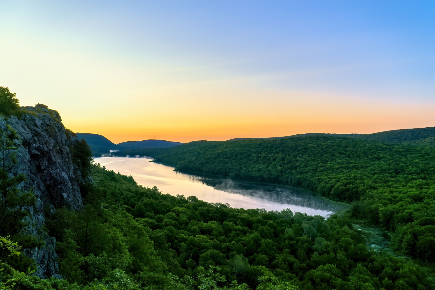
We also drove some of the paved roads in the area too including the incredible Brockway Mountain Drive. This 8.8 mile scenic drive just west of Copper Harbor runs along the ridge of Brockway Mountain and climbs 720 feet above the surface of Lake Superior. It is to 1,320 feet above sea level and offers incredible views of the area and is a great place to catch sunrises and sunsets.
Of course, while we were camping at the tip of the Keweenaw Peninsula, we also explored a couple very cool nature sanctuaries. First we hiked at Estivant Pines which is one of the largest tracts of old-growth Eastern White Pines preserved in Michigan. The sanctuary now totals 2,400 acres and has really nice 2.5 mile loop hiking trail.
We also visited the Mary Macdonald Preserve at Horseshoe Harbor. This sanctuary was established by The Nature Conservancy and now totals 1,200 acres. I actually got to help survey and mark some of the property lines when the sanctuary was expanded in the mid-1980s and I was a communications intern at the Michigan Chapter of The Nature Conservancy.
Our last hike was a 1.4 out and back trail to Montreal Falls. Being located at the mouth of the Montreal River, the falls cascade into Lake Superior over blocky volcanic rocks. This is one of the most unique and beautiful falls in Michigan. There is also an upper falls, but we had to head back before the sun was dipping close to the horizon marking the end of the day and a wonderful trip.
The song for soundtrack of this video is "Sunrise" by my daughter Aspen Jacobsen. It is from her latest Americana folk-pop album 'Love Each Other Right.'
Show Appreciation:
If you appreciate my work, please consider sending me a tip at www.paypal.me/aviserallife